Photogrammetry – a modern solution to old problems
Often, due to the inability to continuously monitor mining activities on surface mines, deviations from the planned state occur. With the advancement and development of technology and new methods of data collection and processing, controlling mining operations is possible almost on a daily basis. How can this problem be quickly and efficiently addressed?
The answer is simple – photogrammetry!
What is photogrammetry?
Photogrammetry is a technique of collecting data (determining the size, shape, or position of an object in space) by capturing, measuring, and interpreting images. Processing digital images enables the creation of 3D models.
Where is photogrammetry applied?
Photogrammetry finds its application in various industries and scientific fields. In mining, and similar technical areas, the application of photogrammetry is manifested through monitoring mining developments, mapping, road layout, material volume measurements, and more.
How are the data collected?
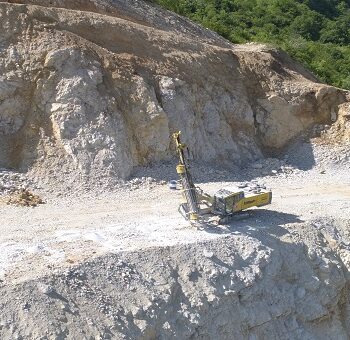
For monitoring mining operations on surface mines, data (images/digital photographs) are collected using unmanned aerial vehicles, or drones (Picture 1). Drones are equipped with high-resolution digital cameras and centimeter-precision GPS, which together enable quality data collection.
Picture 1: Drone imaging
What precedes drone imaging?
Before aerial imaging can take place, it is necessary to plan the flight mission. Flight missions, depending on the terrain requirements, can be planned using licensed applications designed for drone flight planning and control. In order to position the captured images in space, ground control points (GCPs) need to be set up in the field. Ground control points are placed in clearly visible parts of the terrain (Picture 2.a). These points need to be marked by drawing markings on the ground or similar methods, and their precise coordinates must be determined using GPS devices (Picture 2.b).
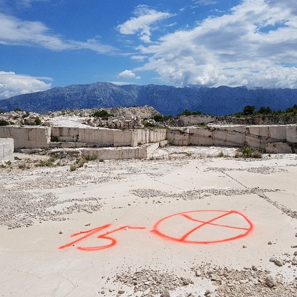
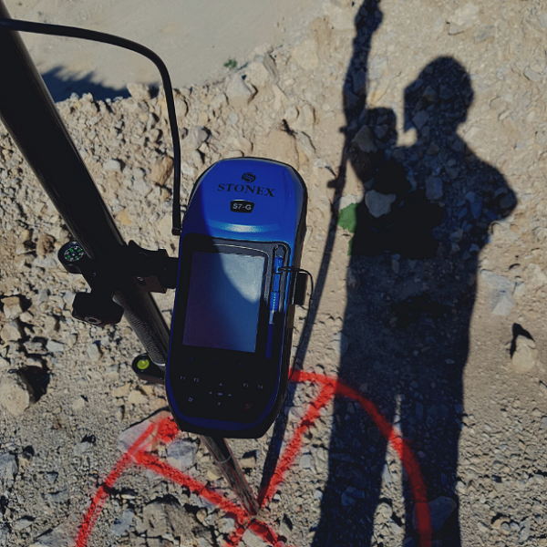
Picture 2: Control points
How are digital photographs captured?
Digital photographs, or aerial photographs, are captured by drones at precisely determined positions in space. Depending on the data collection precision requirements, digital photographs can be taken in one or multiple flights. Additionally, increasing the flight altitude covers a larger area of the terrain but may result in loss of terrain details.
How are the collected data processed?
Aerial photographs taken by drones are processed using specialized software. The processing of collected data involves loading the spatial coordinates of ground control points and captured photographs (Picture 3.a). These coordinates enable proper positioning of all collected photographs in space. The software algorithm reconstructs positioned photographs by filling in the “gaps” from all other available photographs (Picture 3.b).
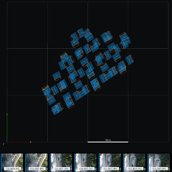
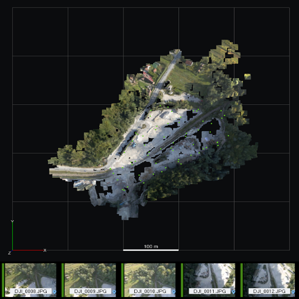
Picture 3: Data processing
What is the result of photogrammetry?
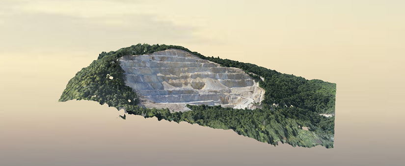
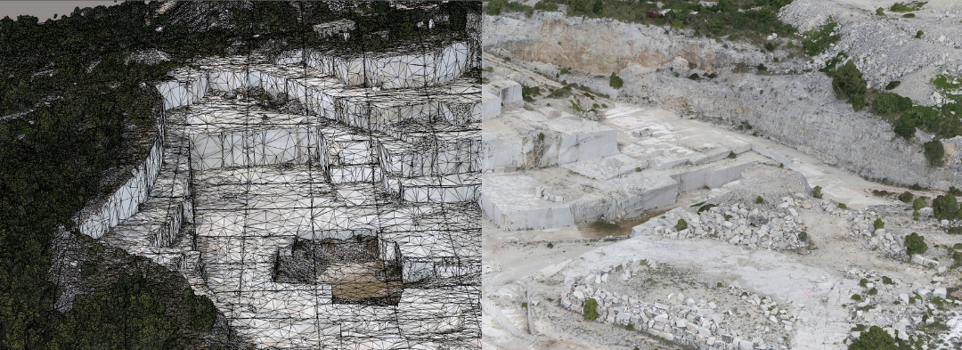
By positioning and processing the captured photographs, a 3D photogrammetric model of the terrain is obtained (Picture 4). Three-dimensional terrain models not only provide insight into the current state of mining operations but are also visually appealing and more informative compared to traditional 2D terrain representations.
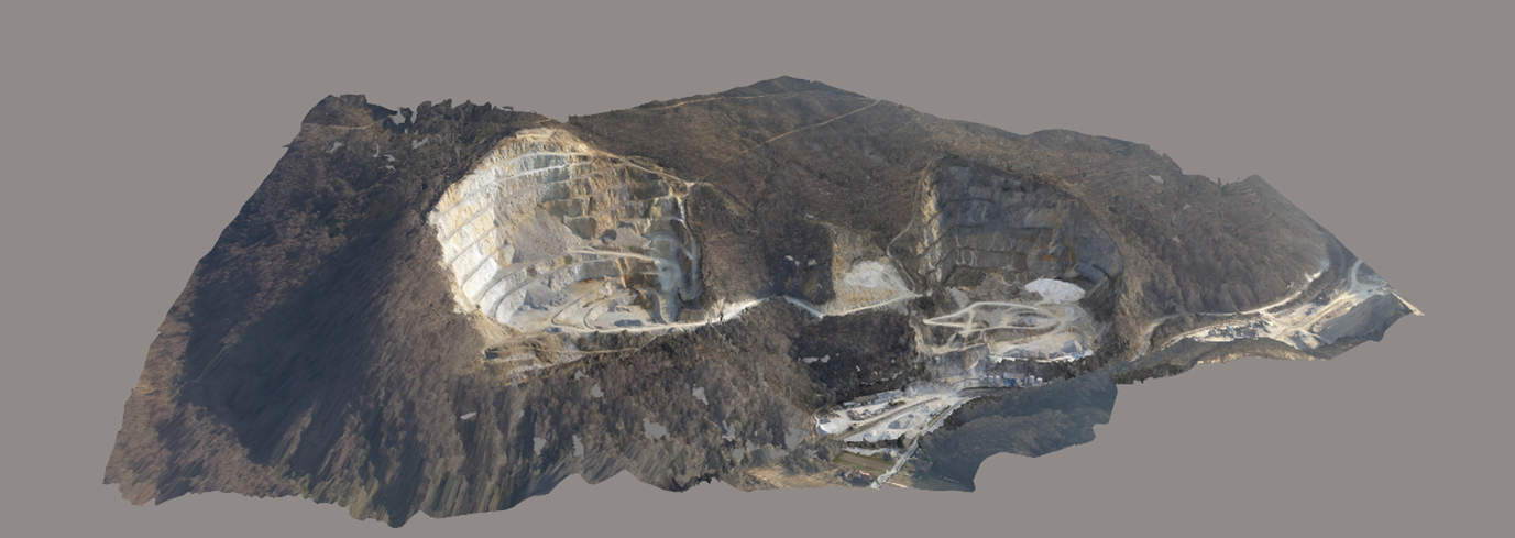
Picture 4: 3D photogrammetric model
What are the advantages of photogrammetry?
The photogrammetric data collection method is not complex in terms of logistics on the field. The process of capturing digital photographs and their subsequent processing does not require the presence of more than one person. Another significant advantage is the time it takes to process the data and obtain the 3D model; the model is ready just a few hours after data collection and processing.
What can 3D photogrammetric models on the surface mine be used for?
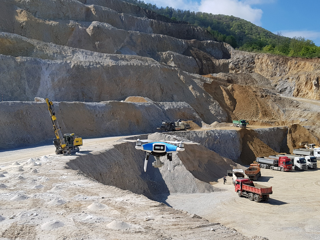
Due to the short time it takes to collect (capture) a large amount of data and the simplicity of their processing, such 3D models are used for frequent monitoring of mining operations and conditions on the site (Picture 5). By overlaying 3D models and 3D projected phases, efficient planning and further development of mining operations are enabled.
Picture 5: Application of photogrammetric model in monitoring of mining operations
On surface mines, the use of 3D models also enables the monitoring of stockpile conditions and the calculation of volumes of material fractions available (Picture 6).
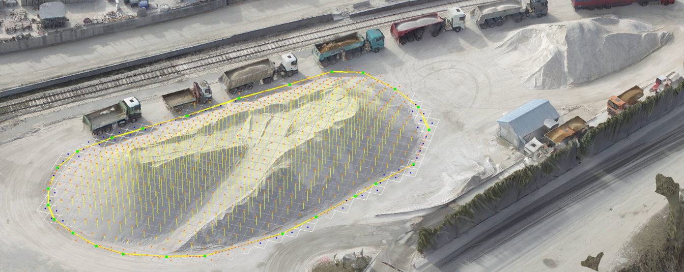
Picture 6: Application of photogrammetric model in monitoring of stockpile conditions
- Posted by Rudar projekt
- On 22nd rujan 2021
- 0 Comment