Exploitation Field of Technical-Construction Stone „Tambura“
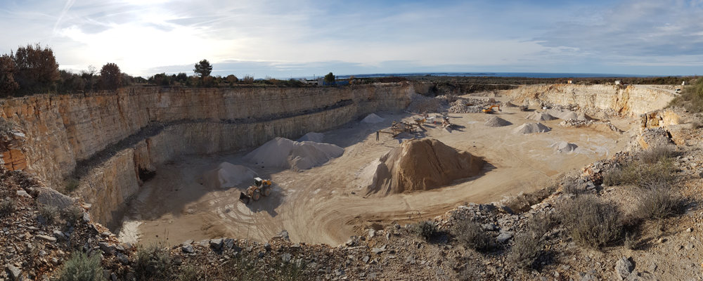
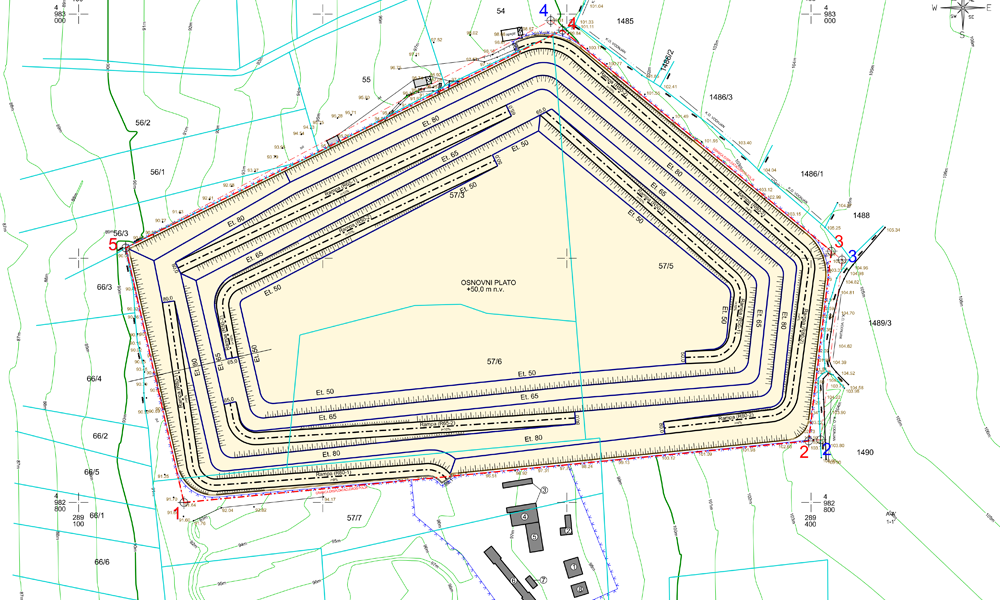
The exploitation field of technical-construction stone “Tambura” is located in the southern part of the Istrian peninsula, about 3 km from its western coast. The surface mine “Tambura” is approximately 277 meters wide and about 184 meters long. The lowest point of the mine before the implementation of project solutions is +80 meters above sea level (base plateau), and the highest point of the mine is 104 meters above sea level, representing a height difference of 24 meters. The general characteristics of the deposit are: a horizontal to subhorizontal layer position and the absence of significant tectonic impact. The subhorizontal layers have a gentle slope (about 5°).
RAW MATERIAL
Technical-construction stone
LOCATION
Fažana Municipality, Istria County, Croatia
EXPLOITATION AREA
38 825 m2
PROJECT DOCUMENTATION:
- Preliminary project for the location permit of the intervention within the exploitation field of technical-construction stone “Tambura”
- Report on obtaining special conditions for the location permit for the exploitation field “Tambura”
- Report on the reserves of technical-construction stone in the exploitation field “Tambura” – fifth renewal
- Environmental impact study of the exploitation of technical-construction stone in the exploitation field “Tambura”
- Request for the change of boundaries of the exploitation field of technical-construction stone “Tambura”
- Report on the preliminary assessment of the acceptability of the exploitation field of technical-construction stone “Tambura” for the ecological network
- Report on the compliance of the exploitation field of technical-construction stone “Tambura” with spatial planning documentation
- Preliminary mining project for the exploitation of technical-construction stone in the exploitation field “Tambura”
- Posted by Rudar projekt
- On 30th kolovoz 2021
- 0 Comment